Google Maps is getting new AI-powered search updates, an enhanced navigation interface and more
Google is adding a slew of new updates for Maps, including a few AI-powered features that are designed to make it easier for users to search, explore their surroundings and get to their destinations. The company is making it easier to find specific items near you and find inspiration for things to do, rolling out navigation interface updates, giving EV drivers more information about chargers, expanding previously announced features to more cities and more.
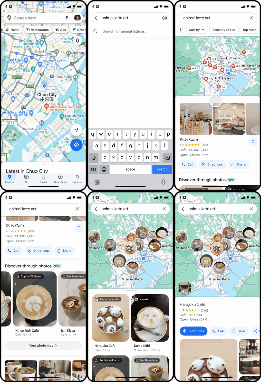
The tech giant is updating Search in Maps to make it easier to find specific things near you. Now, when you search for something like “animal latte art,” you will find photo results of what you are looking for. The results that are shown to you are based on the analysis of photos shared by users on Google Maps thanks to AI and advanced image recognition models. By showing you these images, Google wants to make it easier for you to discover new spots that carry exactly what you’re looking for. In this scenario, if you see an image of cute animal latte art that you like, you can click on it to learn more about the coffee shop that offers it and then navigate to it.

Image Credits: Google
This new way to search in Maps is rolling out in France, Germany, Japan, the U.K. and the U.S. this week. Google plans to expand it to more countries in the future.
Say you have some free time and don’t exactly know what you’re looking for, you will soon start to see better-organized search results about things near you. For instance, if you’re in Tokyo and not sure what to do, you can search for “things to do” to see place suggestions like “anime,” “cherry blossoms” or “art exhibitions.” You can tap on the places and either navigate to them or save them for later. This update, which is designed to help you find activities and dining options, will roll out globally on Android and iOS in the coming weeks.

Image Credits: Google
Google also announced that the Maps navigation interface will soon reflect your surroundings more accurately. For instance, you will see more realistic buildings to better orient yourself when you’re driving downtown. In addition to updated colors through the map, you will now see improved lane details when you’re on the highway, which will be useful in instances where you have to quickly cross multiple lanes to catch your exit. These updates will start to roll out in the coming months in 12 countries, including the U.S., Canada, France and Germany.
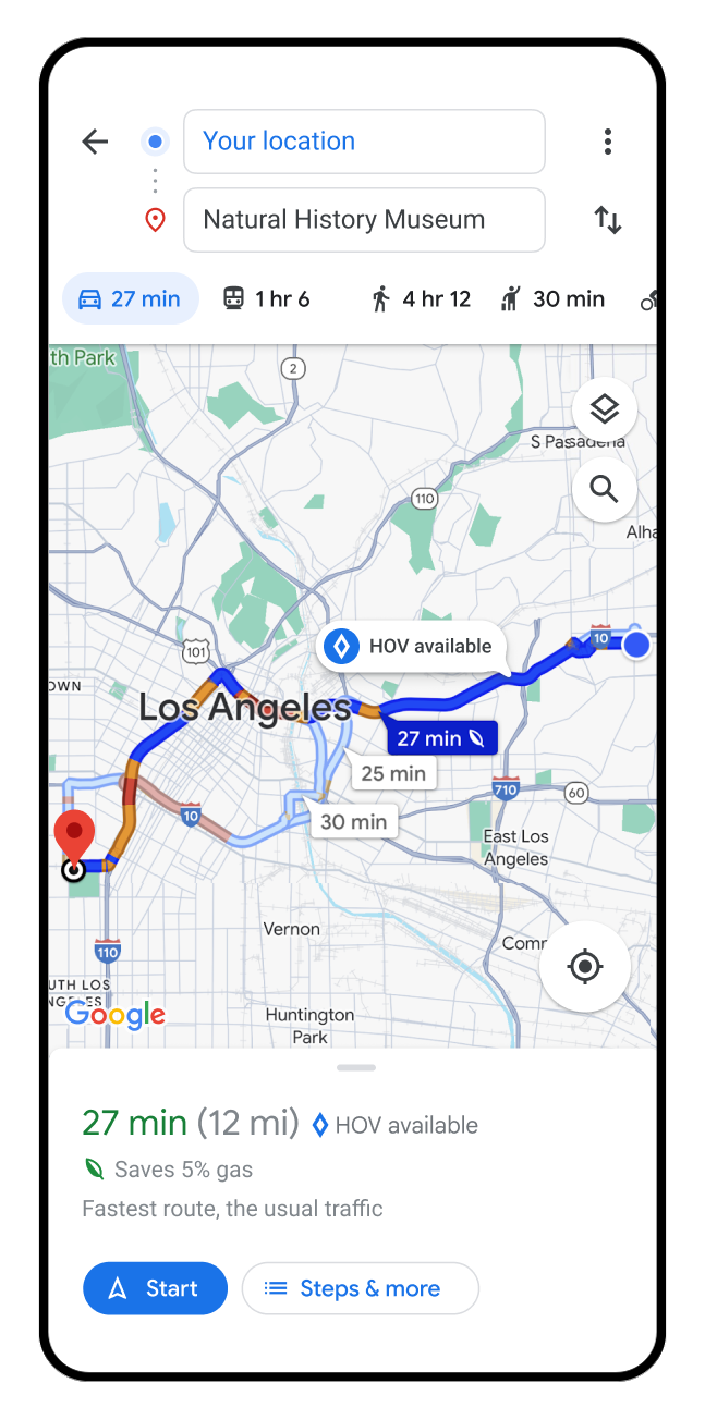
As for drivers in the U.S., they will start to see if there are HOV lanes along their route. And in Europe, Google is expanding its AI-powered speed limit information to 20 countries. Both of these features start rolling out on Android, iOS and for cars with Google Built-in in the coming months.

Image Credits: Google
In addition, EV drivers on Android and iOS will start to see additional information about the charging stations that show up on their map, including whether a charger is compatible with their vehicle and whether the available chargers are fast, medium or slow. You will also be able to see when a charger was last used, so you can be sure it works and don’t end up driving to a broken charger.
As part of today’s announcement Google shared that it is expanding some of its current AI-powered features to more cities. Immersive View for Routes, which lets you preview you journey whether you’re driving or walking, is expanding to Amsterdam, Barcelona, Dublin, Florence, Las Vegas, London, Los Angeles, Miami, New York, Paris, San Francisco, San Jose, Seattle, Tokyo and Venice on Android and iOS.
Google is also bringing Lens in Maps, previously known as Search with Live View, to more than 50 new cities, including Austin, Las Vegas, Rome, São Paulo and Taipei. The feature uses AI and augmented reality to make it easier to understand your surroundings and find information about things like nearby ATMs, transit stations, restaurants and more.

